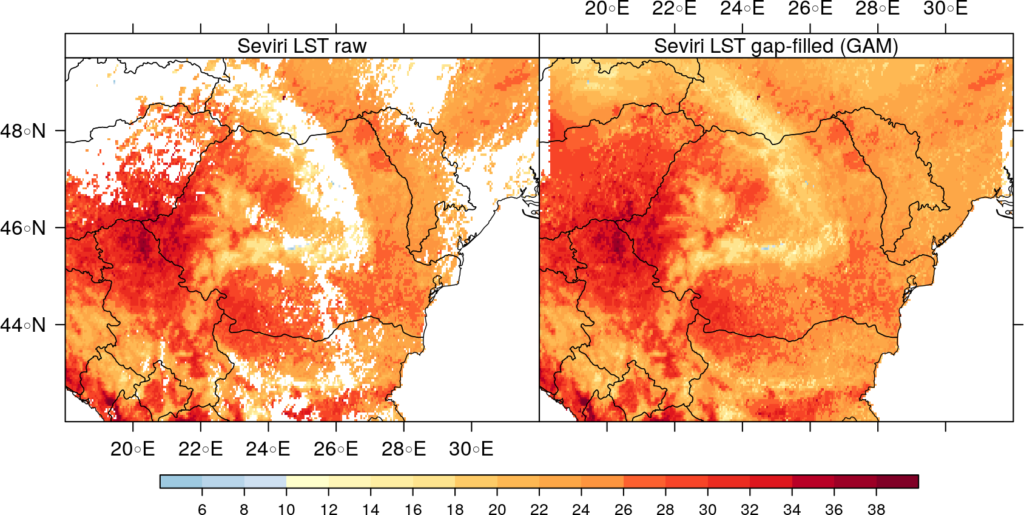
The archives of geostationary land surface temperature (Seviri LST) data product provide high temporal resolution information valuable for analysing the surface urban heat islands, heat and cold waves, monitoring extreme events, etc. The main constraint of satellite infrared LST product is their inability to provide data under cloud-covered areas. In this stage, we tested several existing statistical approaches for filling gaps in the SEVIRI LST imagery time-series.
Two categories of gap-filling approaches used for modelling missing data have been compared: multiple linear regression (MLR) and the general additive models (GAM). The input datasets selected for this analysis was the land surface temperature data over Romania, based on MSG-SEVIRI measurements, which is an is an operational product of the Land Surface Analysis – Satellite Application Facility (LSA-SAF). The product was obtained from the land LSA-SAF archive centre (https://landsaf.ipma.pt/products/disseminationMethod.jsp) for the 2 years period (2016–2017). The data is provided in native geostationary projection, centred at 0° longitude and with a sampling distance of 3 km at the sub-satellite point.
To evaluate the gap-filling approaches, we created artificial gaps in the original LST data, estimated data for these areas and compared the computed LST values to the raw original LST values. The common accuracy indicators for prediction models were computed between estimated and original LST values. The final outcome of this research was the hourly fully gap-free time series of the surface temperature from Seviri LST product (from 2009 to 2017), obtained with the help of the gap-filling approach which performed best (Figure 1).