Since the Seviri LST data are at a coarse spatial resolution that does not allow the study of the detailed spatial-temporal variation of the temperature (e.g. the diurnal variability of the urban heat island), several methods frequently used to improve the spatial resolution of the satellite data have been analyzed.
The downscaling procedure implied the completion of two main stages:
(1) The realization of the monthly LST maps for each month and year analysed (for daytime and nighttime);
(2) The spatial interpolation of the LST hourly anomalies against the monthly climatology, and combining the maps rendering the deviations with the climatic maps.
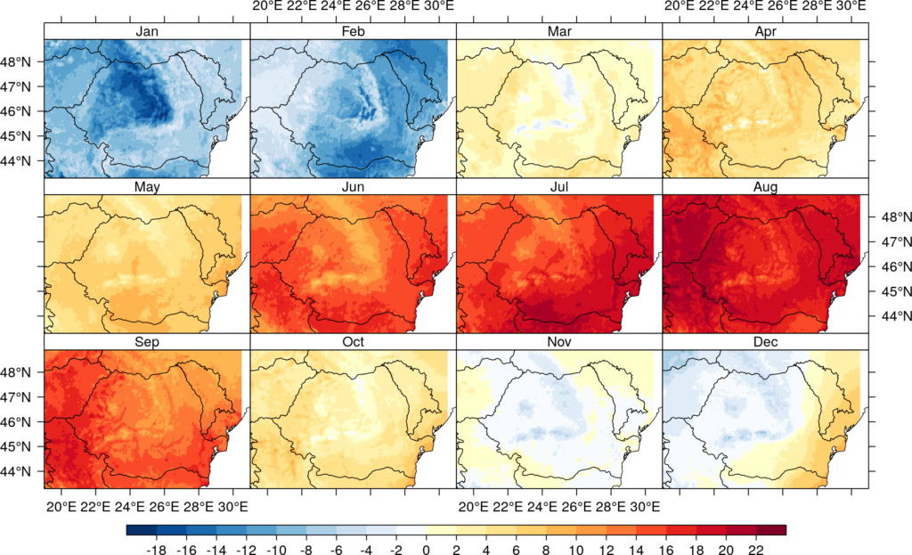
The spatial variability of the data used in the first stage was accounted for through the use of a series of predictors derived from the DEM, Land Cover product, and MODIS LST data, quantified in the interpolation procedure with a multilinear regression model (Figure 1), whereas for constructing the anomaly maps, a simple interpolation method was used (bilinear method).
By applying the above-mentioned procedure, an improved Seviri LST dataset was obtained for the period of interest (2009 – 2017, 78888 hourly maps). The data was archived in daily multidimensional NetCDF files (3287 files).
The good results of the gap-filling and spatial downscaling methods are confirmed by the consistency of the new obtained LST dataset, more precisely by the homogenous representations of the diurnal temperature cycle (FIgure 2).
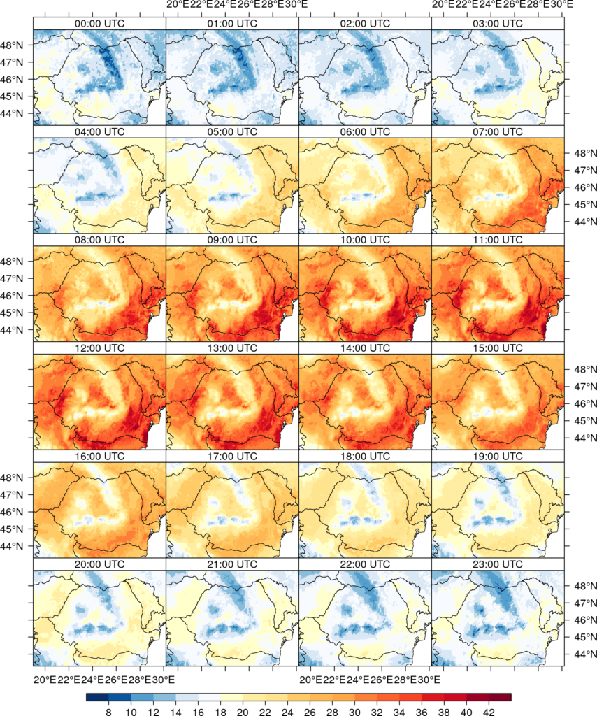
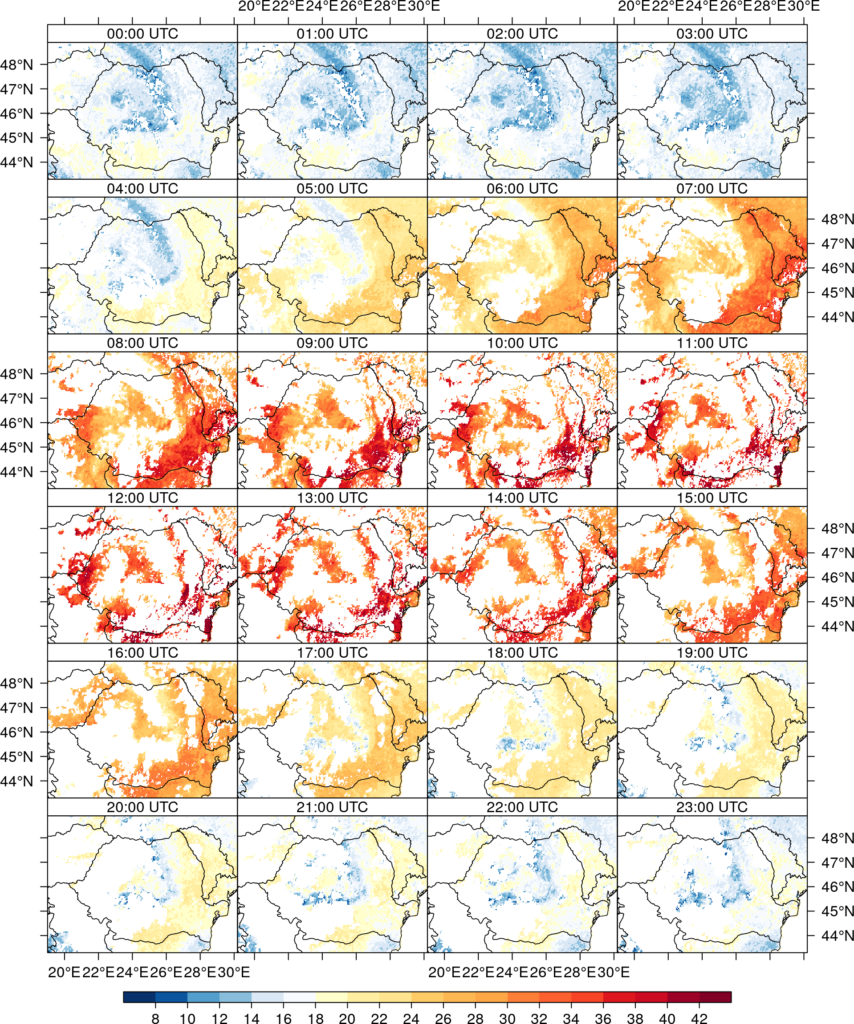
The performances of the methodologies applied in this stage are also demonstrated by a comparative analysis of the initial data (figure 3) with the final ones (figure 2). It is found that regardless of the degree of availability of the initial data, by using the regression models and the appropriate predictors, a homogeneous and complete LST satellite data set can be obtained.